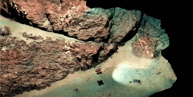
Scientists at the Lyell Centre, a Global Research Institute based at Heriot-Watt University in partnership with the British Geological Survey, are supporting Oban-based Tritonia Scientific in using 3D digital models to map out and monitor complex marine environments and habitats © Tritonia Scientific
The experts in underwater imaging technology are trialling the first-of-its-kind system to test its effectiveness of using remotely operated vehicles (ROVs) to create digital twins of the seabed.
Over the next 12 months, the team at Tritonia, with additional support from the Lyell Centre, seafood producer Mowi, and the Sustainable Aquaculture Innovation Centre (SAIC), will develop a digital record of the hard substrate found at Mowi sites in the Western Isles of Scotland using a technique known as georeferenced photogrammetry.
Compared to soft seabed, where samples of sediment can be collected with relative ease, monitoring hard substrates is challenging. The water environment has low visibility even when using divers or drop-down cameras to assess the terrain. The hard nature of the seabed also makes it nearly impossible to grab samples.
The new system uses underwater ROVs linked to above-water GPS technology and acoustic transponders to capture digital images of the seabed. The images will be used to assess the sea floor at current and potential finfish farms. It will also identify the presence of priority marine features like nationally protected habitats and essential underwater ecosystems for Scotland’s coastal areas.
Dr Heidi Burdett, associate professor at the Lyell Centre noted, “monitoring the effect of coastal industry and human activity on these habitats is crucial for understanding how best to protect them, but it remains logistically difficult. This project will allow us to overcome this using a scalable and flexible approach that brings the seabed into a virtual laboratory.”
Using the images, Tritonia will create an accurate 3D model that can show various physical characteristics and be used alongside advanced comparison software to monitor changes on the seabed. The tech could give aquaculture firms access to accurate digital records of the seabed close to their operations.
Martin Sayer, managing director of Tritonia Scientific explained, “using imaging technology could help the aquaculture sector to gain a much more detailed, accurate picture of the complex seabeds they are operating beside or above. Our hope is that the system could ultimately support regulation and environmental monitoring in ways that would provide the levels of evidence that would be necessary for future sustainable operations."
“At the moment, divers face a range of challenges in terms of visibility and climate, particularly if algal blooms are present, but the digital twin allows us to essentially remove the surrounding water at the click of a button, using images captured by an ROV. Just one survey can generate a 3D model that provides a permanent record of the seabed terrain at a fixed point in time, which could be used for comparisons for years to come,” Sayer said.
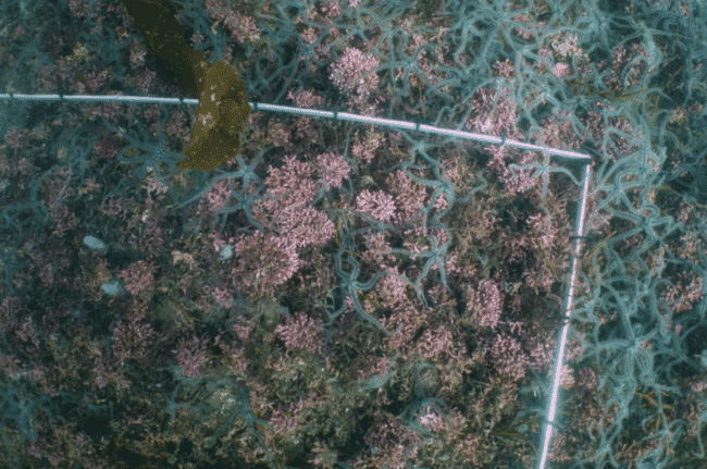
Maerl beds are difficult to map, but are an important consideration for decisions about potential fish farm locations © Tritonia Scientific
A single ROV dive could yield reems of data and images on the volume and area of specific geographic features, giving the aquaculture sector accurate information to aid decision-making. This type of tech could also be instrumental in detecting protected habitats like maerl beds – a critical and fragile form of natural carbon storage. These habitats are difficult to map, but are an important consideration for decisions about potential fish farm locations.
SAIC chief executive Heather Jones said, “we could see ROVs and imaging technology playing a vital role in monitoring the sector’s environmental impact – and increasing its economic impact by supporting future decisions about farm locations and possible expansion.”