A paper in Remote Sensing Applications: Society and Environment outlines a new method for measuring land use changes stemming from shrimp aquaculture. By using remote sensing and aerial photography, researchers from the Norwegian University of Science and Technology were able to map Thailand’s shrimp ponds and accurately assess the land area they occupied. The method also allowed researchers to track changes in forest cover across Thailand and state whether the construction of shrimp ponds was contributing to deforestation and biodiversity loss.
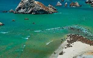
© UNIMA WWF
In addition to giving researchers a more accurate view of the environmental footprint of shrimp aquaculture operations, the paper suggests that remote sensing could provide independent verification for environmental and sustainability claims in the global aquaculture industry.
Thailand’s shrimp boom and a pivot towards sustainability
Thailand’s first forays into shrimp aquaculture began between 1972 and 1987. The farms were usually semi-intensive and production numbers gradually rose until 1988. From 1988 to 1995, the industry rapidly expanded. Shrimp producers intensified their operations and output skyrocketed. However, intensification saw increased disease outbreaks and high mortality rates among farmed shrimp. More than 80 percent of newly established shrimp farms were abandoned after a few years of operation.
In the 1990s, shrimp farmers learned that it was feasible (and profitable) to culture shrimp in former paddy fields. Since the fields were in inland and freshwater areas, producers had to transport salt water to the ponds to maintain output. Though the farms were able to stay in the black, the environment surrounding the paddy fields began to degrade from the newly introduced salt water.
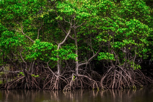
By the late 1990s, researchers noted that shrimp farming was taking an environmental toll. Effluents from the shrimp were causing eutrophication in surrounding water bodies and harming biodiversity. This trend was also noted in shrimp farms that operated in Thailand’s mangroves. Mangroves perform a host of ecosystem services and provide a natural defence against seasonal flooding. To curb the damage, the Thai government banned shrimp farming in freshwater and inland areas in 1998 and moved to protect the remaining mangroves.
How do we know if the industry is becoming more sustainable?
Though official farming restrictions have spurred the industry to adopt more sustainable practices, verifying progress on sustainability claims and environmental remediation is difficult. Researchers have also been unable to say whether land from abandoned shrimp farms has recovered.
This is where strategies like environmental footprinting come in. Footprinting tracks the land use changes and pollution outputs from shrimp farms over time. The idea is that by creating an accurate picture of land use, production inputs and pollution, farmers will be able to take more decisive steps to mitigate environmental damage.
When focusing on land use changes, the researchers noted that most footprinting methods aren’t able to accurately measure how much land space is being used. Cartographers usually need water shape polygons to create accurate maps – this type of data isn’t available in most cases.
In addition, official data from Thailand’s Department of Fisheries only states how many shrimp farms operate in the country – it doesn’t track the number of shrimp ponds or the space they occupy. The available data can’t say how many kilometres of land have been transformed by aquaculture, further complicating the footprinting process.
To get a more accurate picture of the land burden of shrimp farming, the researchers used remote sensing alongside land cover maps to identify changes in land cover stemming from shrimp pond construction. This information allowed the researchers to identify potential shrimp ponds across Thailand and monitor visible changes to the land through aerial photography. From there, they were then able to analyse the data to show changes over time, to see if abandoned farm sites had become ecologically active.
Combining remote sensing with official data
The researchers used global surface water explorer (GSWE) and OpenStreetMap to create a virtual picture of water bodies in Thailand and the larger landscape. That software identified 10 different water categories – the researchers then needed to figure out which water categories would contain shrimp farms.
After this initial mapping and categorisation, the research used data on shrimp farms from Thailand’s Department of Fisheries. Since the official data didn’t list the number of ponds on each farm, the researchers still had to determine which water bodies were shrimp ponds. They also had to distinguish between early shrimp farms and paddy fields, while also accounting for co-culture and polyculture shrimp farms, in which both shrimp and rice are produced.
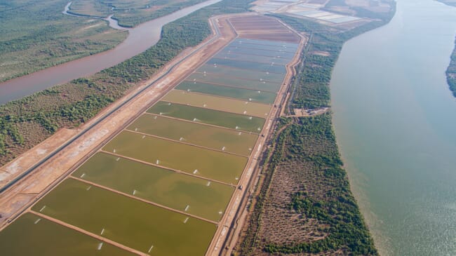
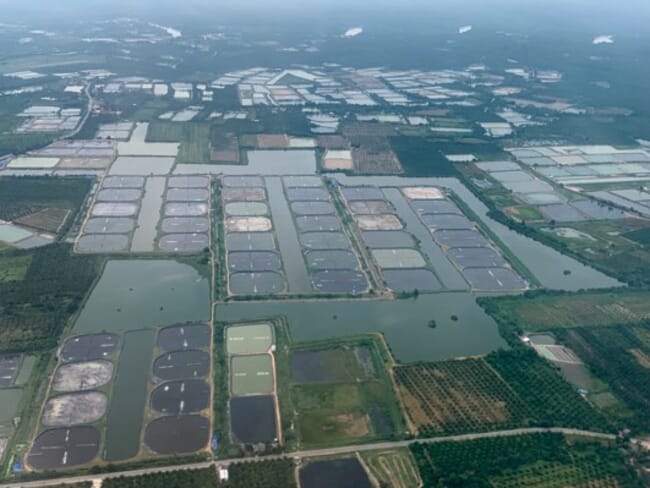
An aerial view of shrimp farms
The researchers estimate that a water area of 1,070 km² has been devoted to shrimp ponds. Their data also suggests that 8 percent of Thailand’s shrimp aquaculture industry takes place in inland waters.
In terms of land change, the researchers estimate that 552.3 km² of Thailand’s shrimp pond area (51.6 percent) was created by transforming primary land. Of this, 56.7 percent was wild forest and 43.3 percent was non-forest. 517.8 km² of the transformed land came from non-primary sources.
The results show that Thailand’s shrimp boom has dramatically changed the natural landscape. Constructing shrimp ponds transformed a significant portion of primary land, including natural mangroves. This loss can offset many of the economic and employment benefits of shrimp aquaculture.
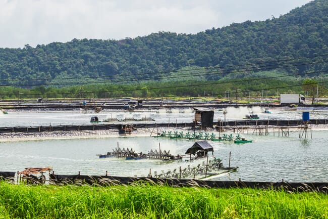
© Andy Shinn
The researchers saw that abandoned farms and land changes from previous production activities are visible in aerial photography. Though many of the abandoned sites appear to be recovering from intensive aquaculture, the change in land use suggests that a renewed push for environmental protection measures may be warranted.
Though the researchers note that the overall accuracy of the remote sensing for coastal shrimp farms was 75 percent, they achieved these results without relying on water area polygons. Despite this limitation, the method would give researchers a useful baseline for gauging changes in land use. It could also be an effective method for verifying environmental remediation efforts in the aquaculture industry.
Read the full analysis in Remote Sensing Applications: Society and Environment.