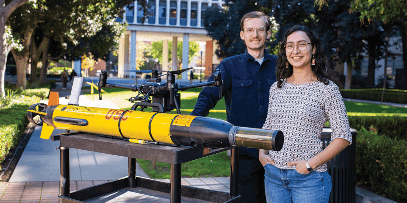
Denniston and Rayas are developing ways for autonomous robots to locate toxic algae in lakes © Emilia Doda, USC
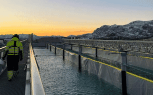
Harmful algae blooms (HABs) in lakes are a major environmental problem, producing extremely dangerous toxins that can taint water supplies or harm other organic life – including people. Biologists can test water safety by collecting samples off the side of a boat, but getting relevant data is no small task, especially in lakes that cover hundreds of miles.
And while algae blooms can spring up anywhere, finding optimal sites to sample is like looking for a needle in a haystack.
As a result, biologists currently find algae concentrations through trial and error and struggle to anticipate new growth, prolonging the discovery of potentially harmful algae and wasting time and labour in the field.
Now, USC computer scientists and biologists have developed a way for autonomous robots to find prime sample spot locations for toxic algae, before a scientist even steps foot onsite. The team recently presented the paper, titled “Informative path planning to estimate quantiles for environmental analysis," at the International Conference on Intelligent Robots and Systems (IROS.)
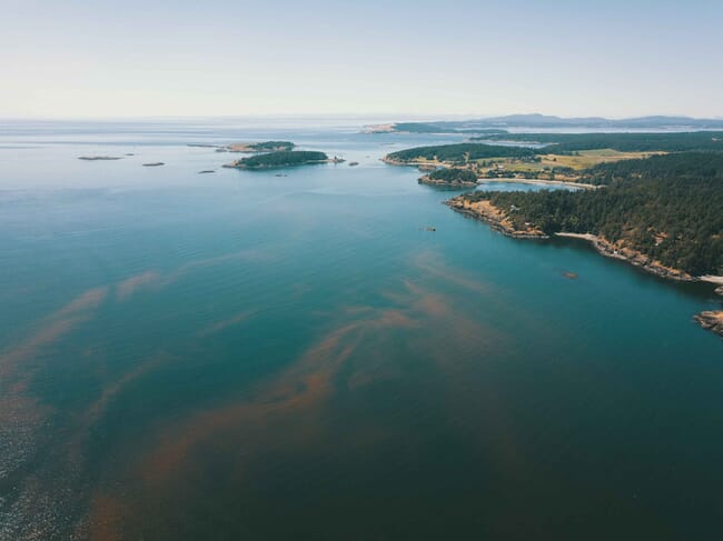
California's lakes, reservoirs and other bodies of water have become saturated with cyanobacteria that can cause toxic algae blooms
“Currently, many robots used by scientists in the real world do not have autonomy or adaptivity,” said co-first author Isabel Rayas, a computer science PhD student advised by Gaurav Sukhatme, a professor of computer science and electrical and computer engineering at the University of Southern California (USC).
“Our work makes it easy for biologists to state what types of areas they would want to collect water from, and the robot can then focus explicitly on taking measurements with that goal in mind. This allows them to save time and collect data more efficiently.”
Locating harmful algae
California is no stranger to harmful algae blooms, especially in recent years as climate change causes temperatures to rise and disrupts water systems. Lakes, reservoirs and other bodies of water have become saturated with cyanobacteria that can cause toxic algae blooms, to the point where those living nearby face health complications from ingesting toxic fumes.
It’s very difficult to fight blooms after they’re in full force. In some cases, the chemicals used to treat water can even make the problem worse. That’s why biologists’ ability to keep tabs on cyanobacteria levels is an extremely important task.
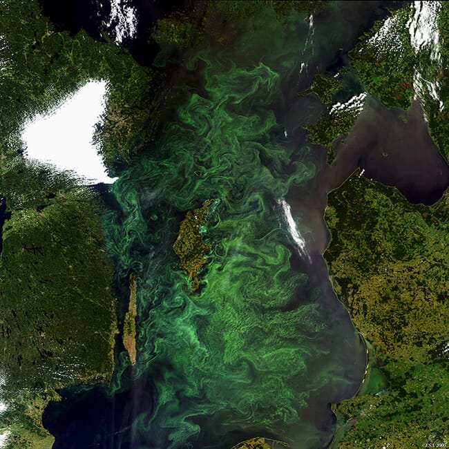
The researchers are using their autonomous robot as a pre-survey to get eyes on an area before biologists go out into the water © ESA
While robots have been used before to help biologists locate algae, they have only been able to give a general overview of the environment. According to study co-first author Chris Denniston, a computer science PhD student, the process also suffers from a “chicken and egg problem.”
“You don’t really know what you would get from sampling the water, and it’s hard to choose where to sample because you don’t have any previous data,” Denniston said. “It’s difficult to know which locations are best to measure without first measuring them.”
Getting eyes on an area
Instead, the USC team’s robots act as a “pre-survey” to get eyes on an area before biologists go out into the field. While biologists have used drones in this process before, the USC team is the first to incorporate planning for this specific kind of task into the robots’ routine, where it will actively seek out traces of algae blooms as it explores the lake according to the biologists’ preference.
For instance, they might ask the robot only to look for locations that meet a certain “quantile of interest,” or, in this case, green spots marking chlorophyll concentrations. Using a camera on a drone, or a chlorophyll sensor on underwater vehicles, this new research focuses on how the algorithm can intelligently select locations to measure toxic algae concentrations, given gathered information.
The new tech means that robots can home in on ideal sampling locations and eliminate the need for biologists to make multiple trips out on the water © UCSB
Now, rather than just giving scientists a more detailed map of an area by exploring it indiscriminately, robots can home in on ideal sampling locations and eliminate the need for biologists to make multiple trips out to the lake just to figure out where algae blooms might be.
The project’s model is “smarter” than the typical devices used by biologists because it maintains a model of its surroundings using informative path planning, or IPP, a type of artificial intelligence that determines the most efficient path for an autonomous system to meet its goal.
Using IPP, the optimal route for the robot to scout for algae is constantly updated, based on the information it gets from its sensors – effectively allowing it to “improvise” where to go, based on what it’s seen already.
Whenever the drone moves, it takes new measurements to progressively update an internal model that informs where to go next. The result is a map that clearly shows areas where algae concentrations would be particularly close to the quantiles – or levels – that biologists would care about. In other words: the ideal place to take samples.
The researchers tested the system’s ability to pick up “green spots” of algae by flying the drone in a field.
“The benefit of using robots is that we are focusing on the data collection specifically for the types of locations that these scientists are interested in,” Rayas said, adding that they are currently expanding the system to work with teams of robots for additional efficiency. “It takes a little bit of the guesswork out and gives more grounded reason for choosing certain locations.”
I’ve got a plan
The study’s co-author, Professor David Caron, a USC professor of biological sciences, has worked with Sukhatme on research combining biology and computer science for more than 15 years.
“As a biologist, I want to know more about what is going on in the water,” Caron said. “Anything that robotics and computer science can do to provide me with insight – extra eyes in the water, if you will – is very valuable to me.”
According to Caron, evaluating bodies of water is extremely labour intensive and anything that saves time or effort is going to be useful.
“If I want to say something about a body of water, I have to get on a boat, I have to go out there in a huge environment and I have to put instruments in the water and collect it,” Caron said. “There just isn’t enough information from something like sensors to be able to make all the measurements I would like.”
Sukhatme attested that biologists are not the only ones reaping the benefits, as taking on problems from other fields can change how computer scientists tackle problems.
“Big problems don’t fit neatly into disciplinary boundaries — you have to think out of the box. For me, as a computer scientist and roboticist, collaborating with Professor Caron’s group has been an education,” Sukhatme said. “We’ve learned how to pose problems in new ways leading to solutions that would have never occurred to us before.”
Both Denniston and Rayas value working with biologists because it’s given them the opportunity to tackle environmental issues using computer science. They believe that their informative path planning model could be applied to other kinds of surveys on land in the future.
“I think it’s really great that we have this collaboration with the biology lab, and it gives us a grounding to why we’re doing what we’re doing and that it’s in the human interest,” Rayas said. “I started working on this because I was looking for a way that robotics can be impactful in a positive way for the environment.”