© CSIRO
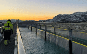
Australia’s Fisheries Research and Development Corporation (FRDC) has funded a suite of research projects aiming to provide scientific knowledge and tools to guide sustainable management of the impacts from salmon farming within Storm Bay – a large, deep bay bounded by the Tasman Peninsula and Bruny Island.
One of the research projects, led by the Australian government agency, Commonwealth Scientific and Industrial Research Organisation (CSIRO), is the Storm Bay Biochemical Modelling and Information System.
Started in July 2018, the project builds an information system that provides water quality observations and model results to support the sustainable management of aquaculture by the Tasmanian Government and salmon industry. The model can accurately simulate local currents and water circulation, nutrient cycling, plankton and dissolved oxygen.
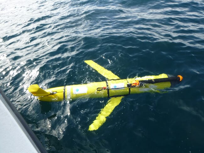
CSIRO researchers used new continuous data collected from moored water quality sensors in Storm Bay, along with autonomous underwater vehicles to collect water quality observations throughout Storm Bay and in the open ocean.
As Dr Karen Wild-Allen, principal research scientist, commented in a press release. “This sort of research is really important as it provides the scientific evidence for environmental regulators, so that they can use this information to make the best decisions at the time for how our coastal waters are managed.”
Senior research scientist, Dr Clothilde Langlais, said the project was created to support the decision making around sustainable and environmentally responsible aquaculture in Tasmania. She added: “This research is here to provide science-based information to stakeholders and managers, so they can take informed decisions. The tool could now be used to answer other questions for strategic management of loads or operations, for long-term planning (climate change) or short-term responses to events (marine heat waves).”
© CSIRO
The project also has the potential for future expansion to multiple sub-regions around Tasmania and Australia, thereby facilitating the sustainable management of aquaculture across a wider geographic area.
What did the report find?
Dr Wild-Allen said the report found the majority of nutrients enter Storm Bay from offshore marine waters and the timing and delivery of these nutrients are modulated by ocean boundary currents, which vary from year to year meaning the offshore nutrient supply to Storm Bay has considerable interannual variability.
She added: “Simulated future scenarios with increased fish farms in Storm Bay predicted changes in water quality that were small, relative to natural interannual variation in nutrient supply to the system. They would be very difficult to detect with a monthly monitoring program, although continuous sensors may more readily identify systematic change.”
Commenting on the report findings, which revealed more fish farm leases in Storm Bay would mean more nutrients sources, Dr Wild-Allen said: “The scenario simulations that explored future management of Storm Bay with additional fish farm leases suggest an increase in ambient nutrient, phytoplankton chlorophyll, and turbidity concentrations. Also, a small decrease in bottom water oxygen and propagation of light to benthic habitat.”
She concluded: “A future scenario based on 2020 anthropogenic loads, plus an additional 3 kilotons of fish farm waste in Storm Bay, shows an increase in the area classified as mesotrophic (medium nutrient, annual mean chlorophyll between 1-3 mg m-3) from 34 percent in a pre-Storm Bay development scenario to 42 percent in this post-Storm Bay development scenario. As well as a corresponding 8 percent reduction in oligotrophic (low nutrient) area.
The final project report is available on the FRDC website.