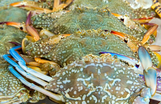
The Bay’s hypoxic (low oxygen) and anoxic (oxygen-free) zones are caused by excess nutrient pollution, primarily from human activities such as agriculture and wastewater. The excess nutrients stimulate an overgrowth of algae, which then sinks and decomposes in the water. The resulting low oxygen levels are insufficient to support most marine life and habitats in near-bottom waters, threatening the Bay’s crabs, oysters, and other fisheries.
Measurements for the Bay’s dead zone go back to 1950, and the 30-year mean maximum dead zone volume is 1.74 cubic miles.
“Despite this year’s forecast, we’ve made great strides in reducing nutrient pollution from various sources entering the Chesapeake Bay, and we are starting to see positive long-term signs,” said Rob Magnien, director of NOAA’s Center for Sponsored Coastal Ocean Research. “However, more work needs to be done to address non-point nutrient pollution from farms and other developed lands, to make the Bay cleaner for its communities and economic interests.”

The anoxic portion of the zone, which contains no oxygen at all, is predicted to be 0.35 cubic miles in early summer, growing to 0.49 cubic miles by late summer – both of which are at or slightly above average. Above average nutrient loading from the Susquehanna River this spring accounts for the overall slightly larger-than-average predicted size of the anoxic portion.
Spring rainfall plays an important role in determining the size of the hypoxic zone. In 2017, the Susquehanna River delivered 81.4 million pounds of nitrogen into the bay, slightly greater than the long-term average. Rainfall amounts were greatest in New York and Pennsylvania, leading to higher than average streamflow into the Bay from the Susquehanna.
The Bay outlook is based on models developed by NOAA-sponsored researchers at the University of Maryland Center for Environmental Science and the University of Michigan. They rely on nutrient loading estimates from the US Geological Survey. Throughout the year, researchers measure oxygen and nutrfish/articles/blue-crabs.jpegient levels as part of the Chesapeake Bay Monitoring Program, run by the Maryland Department of Natural Resources and the Virginia Department of Environmental Quality. This year’s findings will be released in the fall.
“The USGS supports this forecast by calculating nutrient loads based on its streamflow gauges and water-quality sampling sites,” said Don Cline, associate director for the USGS Water Mission Area. “The USGS and Maryland have maintained a monitoring partnership for over thirty years in order to track conditions in the Chesapeake Bay and its tributaries. These data are all publicly accessible at waterdata.usgs.gov."
The anoxic portion of the zone, which contains no oxygen at all, is predicted to be 0.35 cubic miles in early summer, growing to 0.49 cubic miles by late summer – both of which are at or slightly above average. Above average nutrient loading from the Susquehanna River this spring accounts for the overall slightly larger-than-average predicted size of the anoxic portion.
Spring rainfall plays an important role in determining the size of the hypoxic zone. In 2017, the Susquehanna River delivered 81.4 million pounds of nitrogen into the bay, slightly greater than the long-term average. Rainfall amounts were greatest in New York and Pennsylvania, leading to higher than average streamflow into the Bay from the Susquehanna.
The Bay outlook is based on models developed by NOAA-sponsored researchers at the University of Maryland Center for Environmental Science and the University of Michigan. They rely on nutrient loading estimates from the U.S. Geological Survey. Throughout the year, researchers measure oxygen and nutrient levels as part of the Chesapeake Bay Monitoring Program, run by the Maryland Department of Natural Resources and the Virginia Department of Environmental Quality. This year’s findings will be released in the fall.
“The USGS supports this forecast by calculating nutrient loads based on its streamflow gauges and water-quality sampling sites,” said Don Cline, associate director for the USGS Water Mission Area. “The USGS and Maryland have maintained a monitoring partnership for over thirty years in order to track conditions in the Chesapeake Bay and its tributaries. These data are all publicly accessible at waterdata.usgs.gov."


